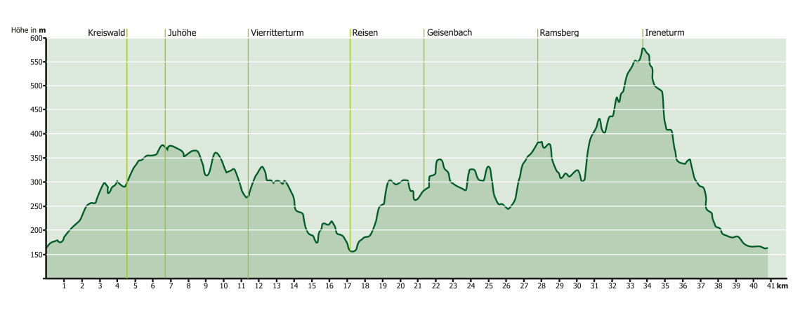
Mörlenbach Mb1
41 km
1250 Hm
Singletrail: S2
Kondition: K2
Technik:
Ø/max ![]()
Für Familien: nicht empfehlenswert


„
Ambitious cyclists will find their challenge here. With over 1250 meters of elevation gain and a length of more than 40 kilometers, the route is very demanding on your fitness. A few single trails are also interspersed with variety. Once you have reached the Irene Tower, it is a well-deserved descent.
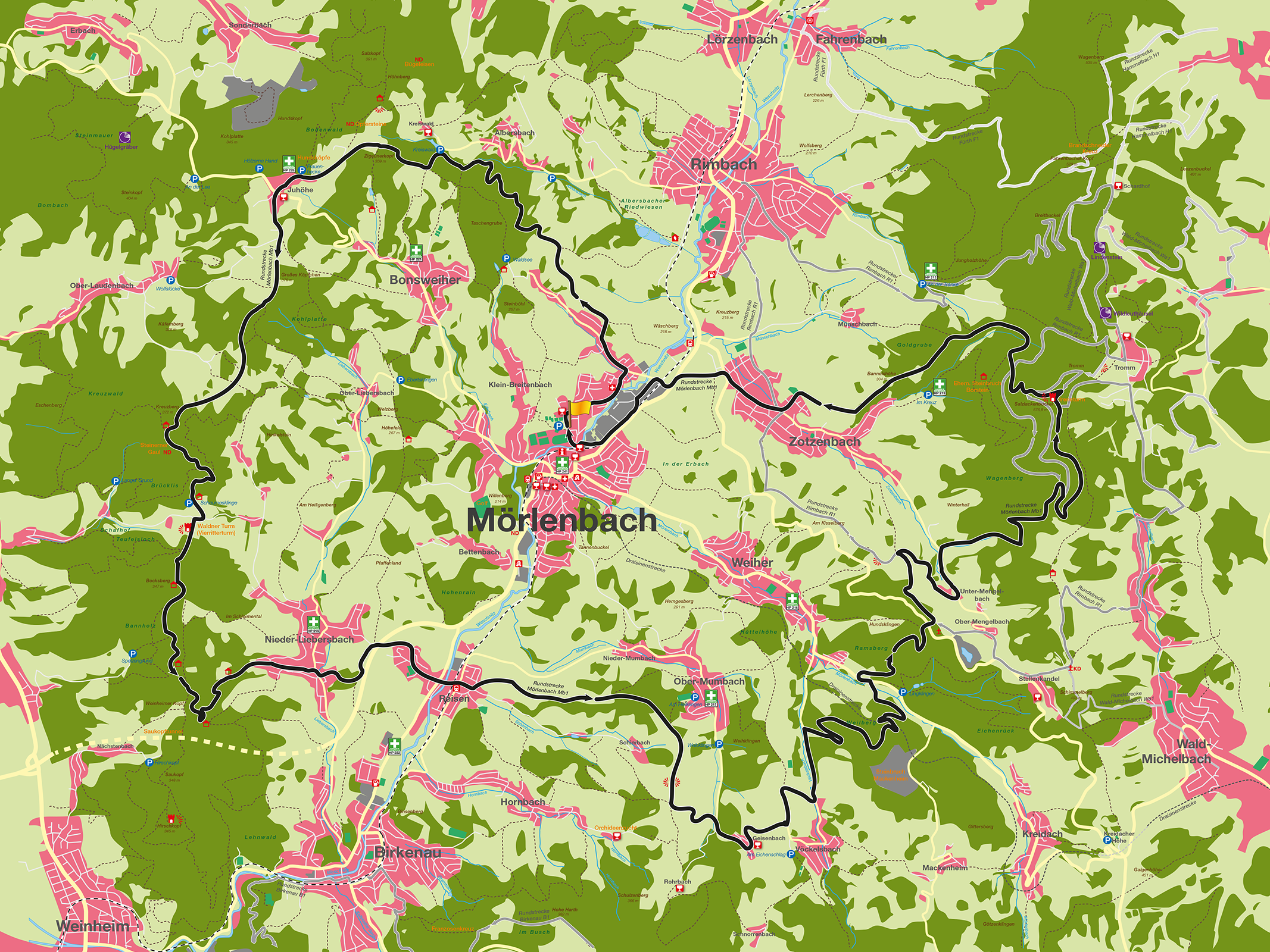
The Mörlenbach MTB route Mb 1 is for the ambitious cyclist who is looking for both altitude and beautiful views, but also wants to be challenged on a few single trails. We start at the community center, leave Mörlenbach at the northern end and head towards the Kreiswald forest. This warms us up for the next 40km or so. Once we reach the Kreiswald forest after a singletrail, we leave it on the right and head straight to the Juhöhe. The first refreshment stop, the Waldschenke Fuhr, awaits you there. We now wind our way along the mountains parallel to the wine route, over the big head, past the stone horse to the four knights‘ tower. Here you have a clear view of the entire Rhine plain to the right and the course of the Weschnitz river, which gave the region its name (Weschnitz Valley), to the left. You can also see the mountain range opposite and the Tromm, which will be our last summit at the end of the circuit. We now continue along the ridge. Ambitious cyclists can make a detour to the Hirschkopf tower (346 m), which once again guarantees a fabulous view. Otherwise, we meander downhill past a spring through Niederliebersbach and, after working our way up a singletrail, cross the B 38. On the bridge, we once again have a clear view of Reisen and the valley. After traveling, a few steep climbs await us. We wind our way past small villages. Here, too, you have the option of making an additional loop over the Götzenstein by continuing along the high trail. As we pass through Geisenbach, another refreshment stop awaits us to fortify us for the following ride up the Tromm. Now we reduce a few meters in altitude and then we can take a look at the trolley line as we cross the Wellberg. Once we reach the end of Weiher, another few meters of altitude await us: the Ramsberg. After a few leisurely meters on dirt tracks and roads, we leave Untermengelbach via the steep Boppen along the „Mengelbach“ and now set a direct course for the Tromm, the 6th highest mountain in the Odenwald. A few hundred meters later, we reach the site of the former Irene Tower and the newly built Tromm Tower. A magnificent panoramic view over the Weschnitz Valley and the Odenwald awaits us on the 577-metre-high Tromm and the 33.5-metre-high observation tower. Here, too, you can take a break in one of the restaurants on the Tromm. Now comes the most technically demanding part: the descent from the Tromm, which requires our skills, adrenaline and hundreds of meters of altitude gained. However, if you take the detour on the descent from the Tromm, the technical demands of the tour are only S0 and therefore rideable for almost everyone. Once we reach the bottom, we let it roll down through Zotzenbach along the B 38 to our starting point at the Bürgerhaus.
For families: not recommended
Technical requirements: high

GPX-Download
(gpx & kml als Zip-Datei)
Start Google Maps
Mörlenbach