Search
Close this search box.

Grass-Ellenbach Gr-E1

28 km
580 Hm
Singletrail: S0
Condition: K1

Technology:

Ø/max

For families: suitable

“In the footsteps of the Nibelungs”, the route leads past the legendary Sigfriedbrunnen fountain, among other places. Over smaller trails and gravel paths, through an old, steep ravine, the route also offers all kinds of culinary stops for the whole family.
“In the footsteps of the Nibelungs” – From the start and finish point at the Nibelungenhalle (tourist office, tourist information office, e-bike charging station, public toilet, restaurant), the route first goes up the “hill” and from there directly towards the forest or the 547 m high Spessartskopf. The route climbs moderately above the climatic health resort of Wahlen to the Affolterbacher Höhe (505 m above sea level). The oldest “traffic sign” in Germany is located at this prominent crossroads: carved in stone, it warned the iron-wheeled carriage driver to use the wooden “wheel shoes” to protect the sandstone pavement of the time. The connection to the Aschbach circuit also branches off at this junction. The route continues in a northerly direction, past the “Red Water” nature reserve, which takes its name from the glowing red flowering sundew, up to the Spessartskopf (547m above sea level), where the next attraction awaits: The legendary Siegfried Fountain, where the gloomy Hagen once slew Siegfried, founded the tourist boom of the entire region in the former hunting grounds of the Nibelungs. Trails and gravel paths lead us to the Drei Eichen forest crossing. An old, steep hollow path, which, as usual, collects branches and stones covered with leaves throughout the year, requires all concentration and steering skills. Suddenly, the picturesque Güttersbach with its little Gothic church appears at the edge of the forest. Guests can choose from rustic village inns to wellness hotels. Bikers can reward themselves in the beer garden or in the open-air swimming pool directly on the route before heading back up towards Dachsberg via the secluded Mösselbach valley. Along the way, the “Weißfraubrunnen” geo-point offers a quiet rest. In the last third of the route, we take the Kirchberg (493m above sea level) via the Köhlerhütte and the Fuchseiche as the final hurdle. Only downhill, via the tranquil Striethtal valley, the route leads us back to the starting point. You can expect an eventful circuit with average fitness and technical requirements, a great natural experience and opportunities to link up with several adjacent circuits.

Suitable for families
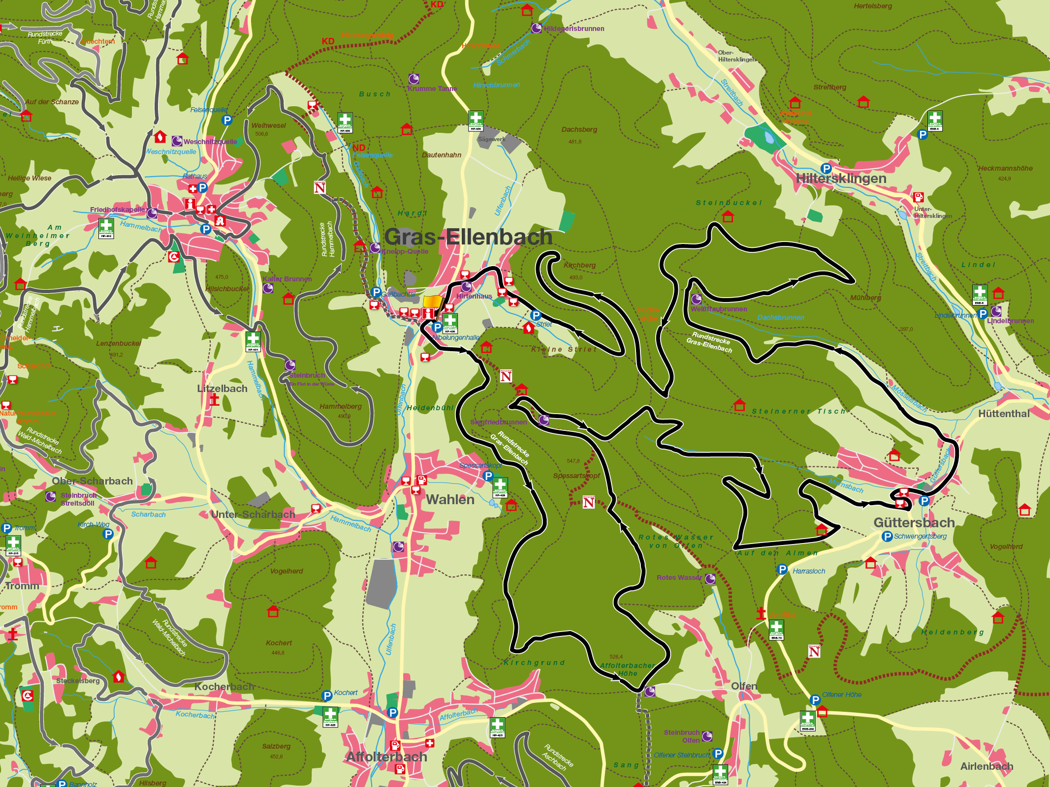
Technical requirements: medium

Gerald Keßler
Route sponsor Go 1
Contact via:
info@mtb-geo-naturpark.de


Peter Bauer
Route sponsor Go 1
Contact via:
info@mtb-geo-naturpark.de

GPX download

(gpx & kml as zip file)

Start Google Maps