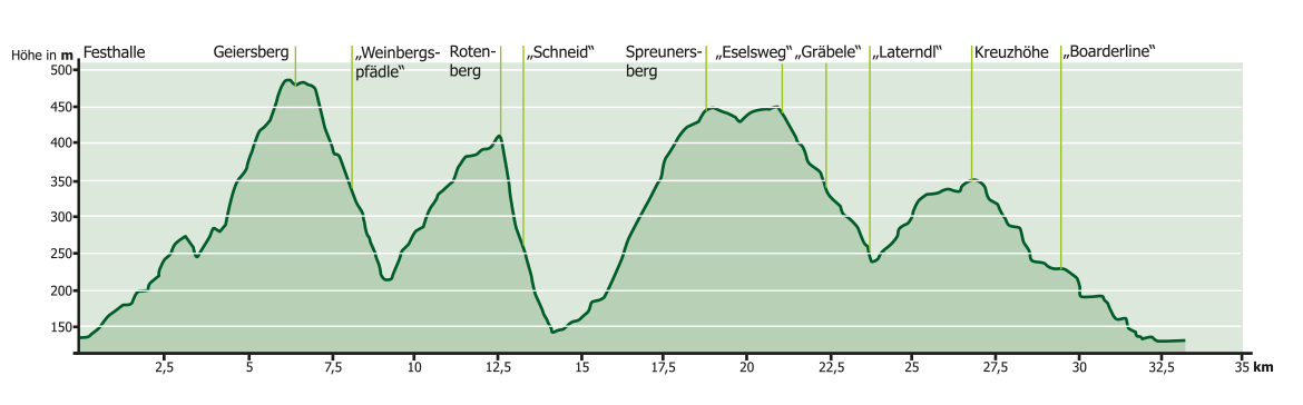
Ø/max ![]()
For families: not recommended
Technical requirements: high
 Guido Weikinger
Route sponsor Co 1
Contact via:<a class="sppb-person-email" href="mailto:Kontakt%20%C3%BCber:
%20info@mtb-geo-naturpark.de”>
info@mtb-geo-naturpark.de
Ø/max ![]()


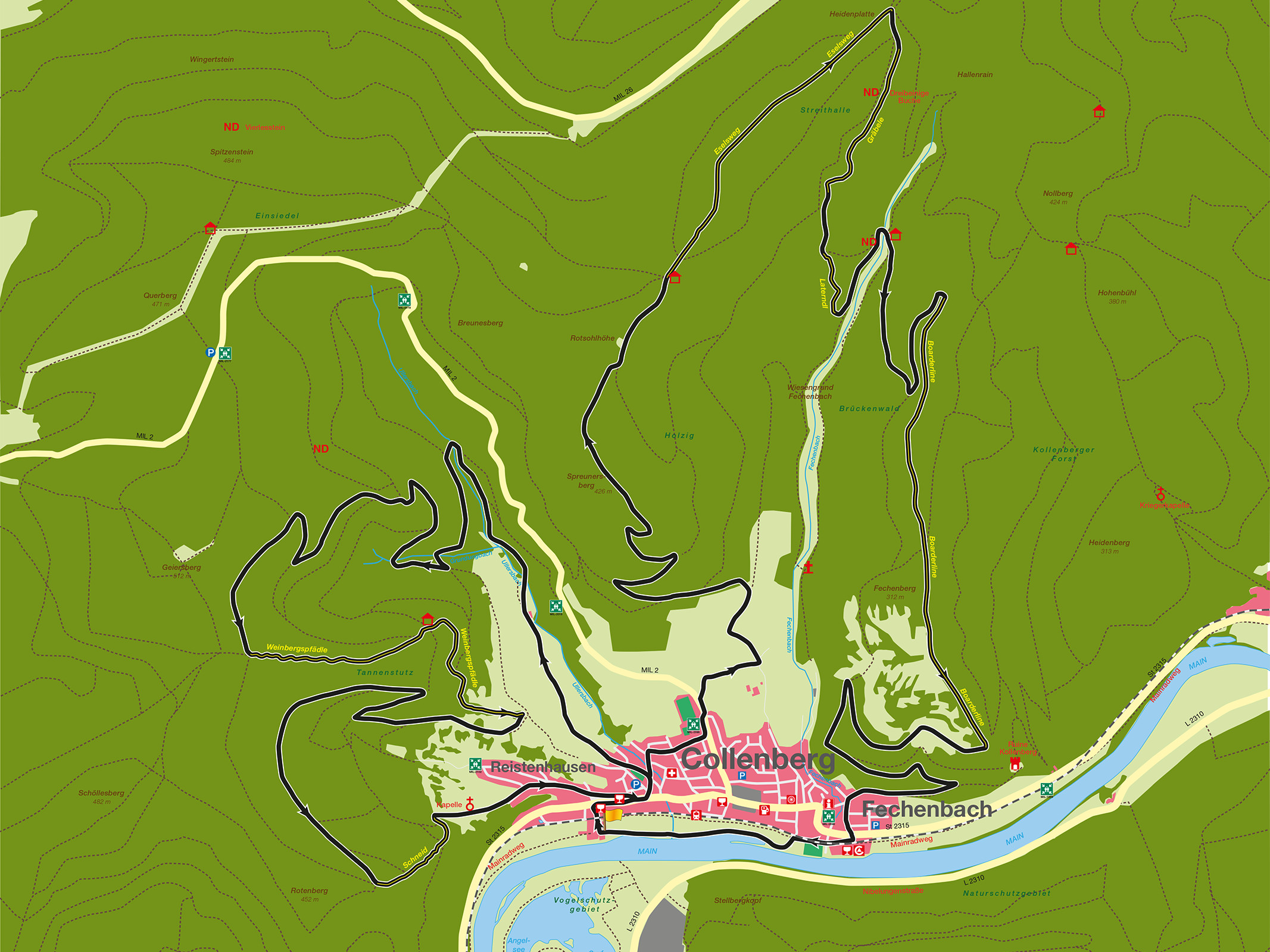
For families: not recommended
Technical requirements: high
Guido Weikinger