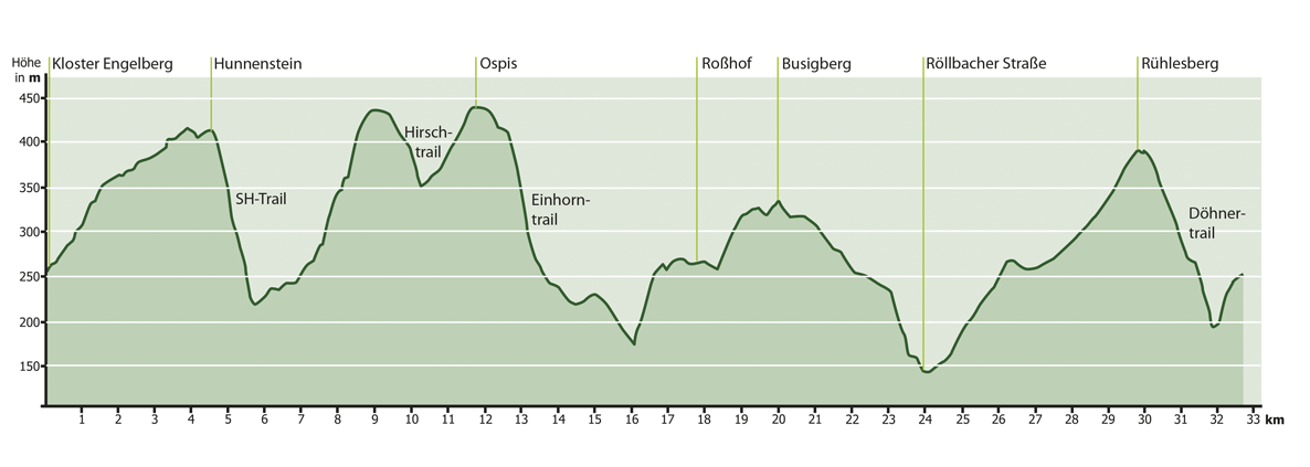
Search
Close this search box.

Großheubach GH1

Mountain bike circuit adjacent to the Geo-Nature Park

32 km
900 Hm
Singletrail: S2
Condition: K2

Technology:

Ø/max

For families: not recommended

The #Böhnertrails: meeting place for young and old on the edge of the Spessart
The starting point of the 32 km and 900 m elevation gain circular route is the parking lot at Engelberg Monastery. Following the signs, the route climbs moderately uphill on forest paths to overcome the height of the Rühlesberg. Once at the top, the route continues along a section of the Donkey Trail. Follow this on the ridge, past the Hunnenstein, to the start of the Hunnenstein Trail. This is where the trail fun begins. Flowy and playful, the trail meanders down the first few meters until it ends at the start of the SH Trail. Now it’s time for full concentration: while the first section is still steep, peppered with roots and steps, the trail shows its gentler, but no less technically demanding side in the lower section. The trail offers a varied experience for all bikers, even for those who prefer to tackle tricky passages with caution: Particularly challenging sections of the trail can be easily bypassed. The route leads over two steep climbs past a mountain hut to the Hirschtrail, which follows the natural course of the terrain and provides a foretaste of the descents that follow. After a short climb to the highest point of Großheubach, the Ospis, and the passage of the Historischer Saustall, two more trails await. First, the Unicorn Trail with its rocks, roots, berms and steps challenges bikers’ skills. More moderate, but no less exciting, is the transition directly afterwards to the RehKIDS trail. Once you have mastered this section of the trail, the view opens up down to the Klotzenhof, which has several inns where you can stop for a bite to eat. Following the signs with arrows, the circuit finally leads down to the state road on an asphalt path before reaching the trial area after crossing it. The route climbs steeply through former quarries to the heights of the Roßhof, where the effort of the ascent is immediately rewarded: The trail leads across meadows and fields to the rest area on the Busigberg, where the magnificent view of the Main valley and the Odenwald will quickly make you forget the exertions of some of the tricky passages. After the descent back into the valley, you first cross the village of Großheubach before the route climbs one last time along forest paths and past the Pfaffenbrunnen fountain. A real classic awaits here – the Döhnertrail, a true playground for young and old. Northshore, curves, steps, smaller jumps paired with a varied surface: once again, everyone gets their money’s worth here. Now the #Böhnertrails are almost done. The route leads back to Engelberg, the starting point of the GH1 tour, along natural paths. After enjoying the wonderful view, the monastery tavern or one of the many traditional restaurants and typical Franconian bakeries in Großheubach invite you to round off the tour.

For families: not recommended
Technical requirements: high
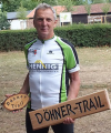
Paul Döhner
Route sponsor GH 1
Contact via:
info@mtb-geo-naturpark.de

GPX download

(gpx & kml as zip file)

Start on Google Maps