Modautal Mo1
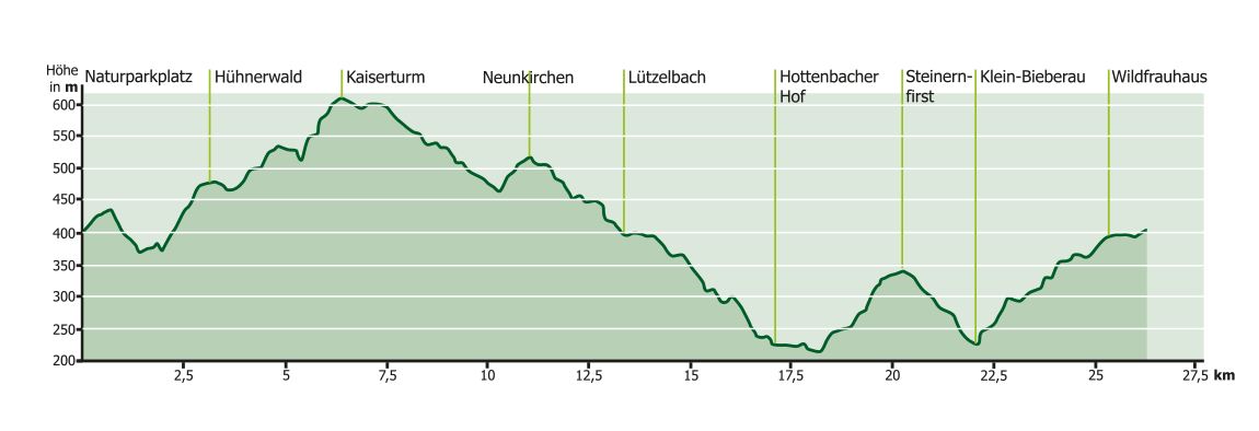
26,5 km
743 Hm
Singletrail: S0
Kondition: K1
Technik:
Ø/max ![]()
Für Familien: nicht empfehlenswert


„
A varied landscape and impressive views make this technically relatively easy route a great family tour. You cross a few small streams and climb the path up to the Kaiserturm. The beer garden in Neunkirchen has all sorts of things in store for thirsty throats and hungry bellies.
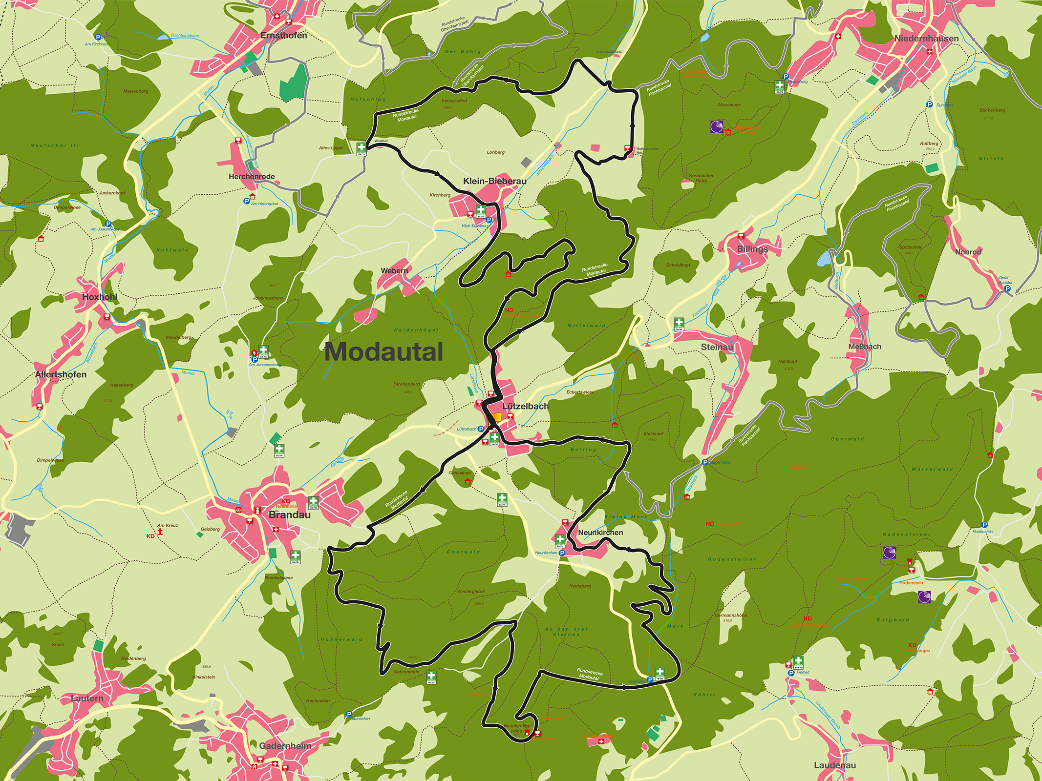
The circular route is characterized by a varied landscape with impressive views. Technically relatively easy, as it mostly runs on forest and woodland paths, but the meters of altitude to be covered require some fitness. The Mo1 circular route consists of two sections and starts at the nature park parking lot at the entrance to Lützelbach, coming from Brandau. The first section initially leads along a dirt track over a hill in the direction of Brandau. After a short descent through the forest, the path leads along the edge of the forest, accompanied by a beautiful meadow valley. It then turns left, continues along the edge of the forest and soon opens up a beautiful view of Brandau and the Felsberg. The path now leads uphill through the Hühnerwald forest, which is the first fitness test. At the intermediate altitude, the route leads along the foot of the Gehrenstein towards Neunkirchen. You pass a few small streams and a beautiful forest meadow. Then the ascent to the Kaiserturm is on mostly natural, partly rocky paths. The Kaiserturm is a viewing tower that offers impressive panoramic views. It stands at an altitude of 605 m and thus at the highest point of the front Odenwald. The ascent in the tower or a stop in the rustic restaurant is possible at the weekend. The trail now initially leads in the direction of Neunkirchen, then turns onto the wine trail in the direction of the Rodenstein castle ruins. After crossing the L3399, the path soon turns left. This is followed by a brisk descent with a few bends before heading uphill again to the center of Neunkirchen. Neunkirchen has a beautiful village square, bordered by the beer garden of a restaurant. Another restaurant is just a few meters away, from where you have a magnificent view as far as the Taunus. Next door is a baroque church that is well worth seeing. From here, the route leads downhill towards Steinau to the Steinkopf forest area. At a shelter in the forest, turn left towards Lützelbach to the starting point. Two restaurants with beer gardens and a café invite you to take a break. The next section leads in the direction of Klein-Bieberau. At the edge of the forest, the route runs downhill to the right on mainly natural paths for a long stretch through a varied mixed forest. As you leave the forest, there are beautiful views again. A meadow path on the right leads to the Hottenbacher Hof, where a popular snack bar with beer garden invites you to stop for a bite to eat. The path then leads through the valley for a while and then to the next ascent through the Steinernfirst forest area. At the edge of the forest, there is a great view of the Johannisbach valley with the village of Klein-Bieberau. From the top of the hill, take a dirt track downhill and a short route through the village. The route now leads uphill on a forest path to Bonin-Brünnchen, an idyllic place with a stream, a refuge and benches. On the further ascent, the path leads close to some rock formations. The Wildfrauhaus natural monument is particularly distinctive. Once you reach the edge of the forest, the trail leads through Lützelbach to the starting point.
For families: not recommended
Technical requirements: low
 Harald Weiser
Route sponsor Mo1
Contact via:
info@mtb-geo-naturpark.de
 Georg Marx
Route sponsor Mo1
Contact via:
info@mtb-geo-naturpark.de
GPX-Download
(gpx & kml als Zip-Datei)
Start Google Maps
Modautatl