Eisenbach/Obernburg Ei1
31 km
747 Hm
Singletrail: S0
Kondition: K1
Technik:
Ø/max ![]()
Für Familien: geeignet


„
This route boasts historic paths, which were already used by the Romans, and magnificent views of the Spessart and Maintail. Even less fit bikers can tackle it well and, thanks to the good surface, at any time of year.
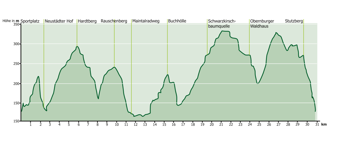
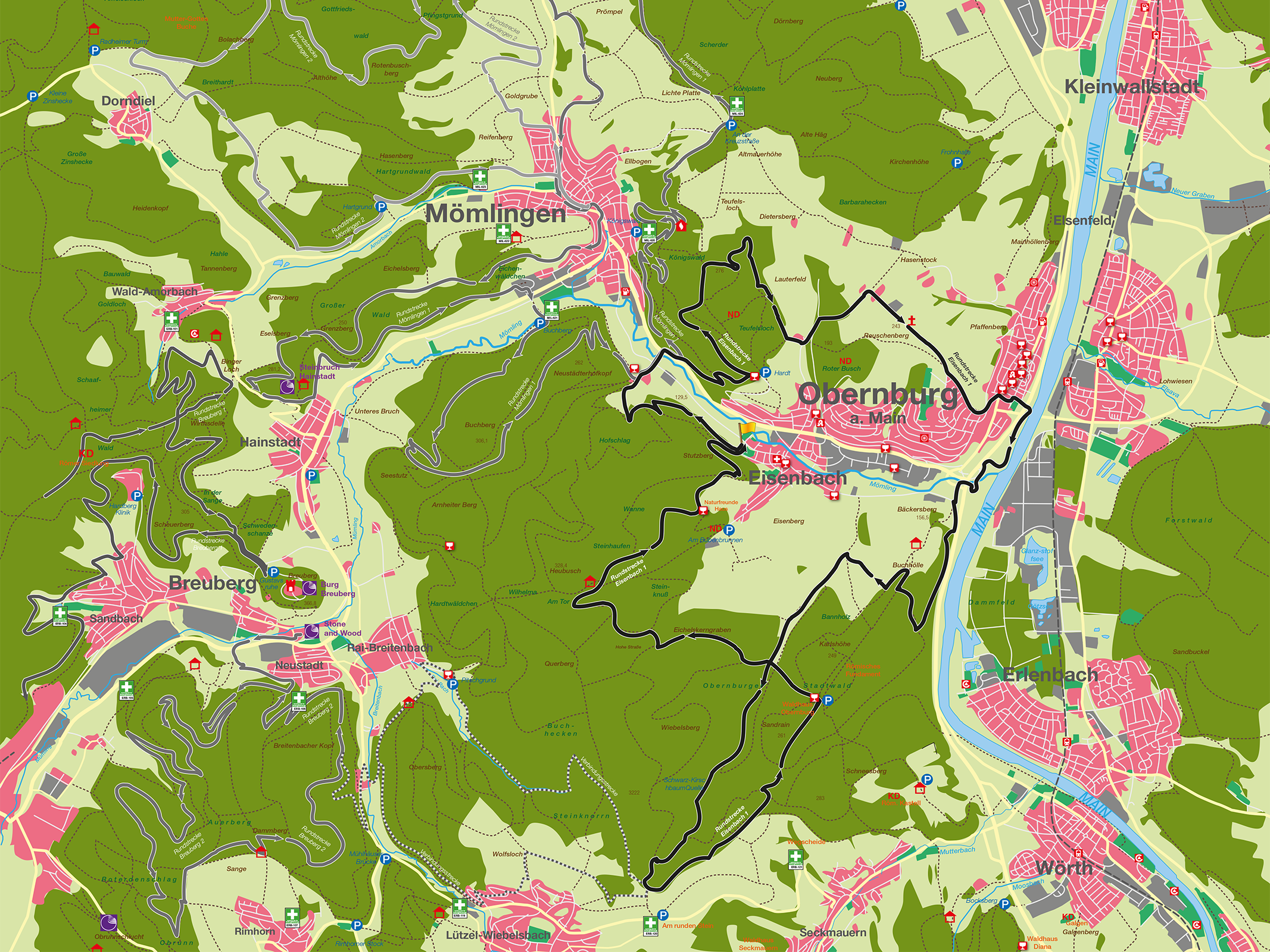
The 31 km long Ei 1 route runs mainly on field and forest paths in the Obernburg and Eisenbach districts. Over the course of the varied route, there are always wonderful views of the Spessart and the beautiful Main valley, and we also follow some historical paths dating back to Roman times. The route has been deliberately chosen so that it is also suitable for less fit bikers. Furthermore, the ratio of ascents to descents is chosen in such a way that there are always good opportunities for fitness recovery. The route can also be used all year round. About 15% of the route is on beautiful trails, about 10% on natural paths, 10% on asphalt and the rest on gravel paths. The route starts and finishes at the sports field in Eisenbach on Wiesentalstraße. From here, the route runs along the edge of the forest on a natural path towards Neustädter Hof. The first technical challenge comes after approx. 1 km with a short, crisp descent in the Zigeunergraben to the Neustädter Hof. From here we cross the B426, running parallel to the Mö1 route, to climb the Hardtberg. Now it’s time for the first long descent on gravel down into the Teufelsgraben, past the Lauterhof to reach the Rauschenberg, from where you can enjoy the magnificent view of the Maintail and the Vorspessart at the wayside shrine. From Rauschenberg, 243 m above sea level, the second longer descent takes us down into the Main valley, past the Protestant church and over the traffic circle onto the Main valley cycle path. Now the route runs up the Main towards Wörth, we briefly follow the Mömling, and then follow the Steinweg at the Obernburger Wasserhaus, which ends after about 500 meters. again offers a magnificent view of the Main valley towards Erlenbach. From here we reach the Grundweg, which we follow past the Schwarzkirschbaumquelle to the highest point of Obernburg at 329 meters above sea level. Here we follow the border between Bavaria and Hesse to reach the Obernburger Waldhaus. The route now crosses the Grundweg and leads us on gravel paths up the Eichelkerngraben to Hohe Straße in the direction of the Eisenbach refuge. Passing this, we finally reach the Stutzberg, where we can once again enjoy a view of Eisenbach and Obernburg. From here, the route leads back down the gravel path to the starting point. There is a bike training area in the immediate vicinity, which is maintained by a club. At the end of the route, the speedometer shows 30.8 km or 747 m difference in altitude.
Suitable for families
Technical requirements: low
 Alfred Bergmann
Route sponsor egg 1
Contact via:
info@mtb-geo-naturpark.de
GPX-Download
(gpx & kml als Zip-Datei)
Start Google Maps
Obernburg