This route runs from the northern and southern ridges over the Kallstädter Tal valley to Löhrbach and Götzenstein. A steady uphill and downhill route offers impressive views of the Odenwald, the Weschnitz valley and the Rhine plain. A treat for all cycling enthusiasts!
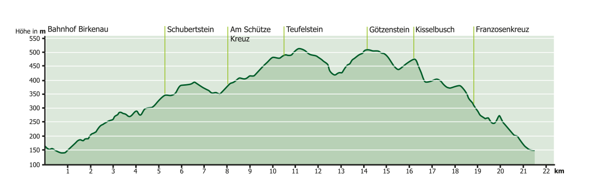
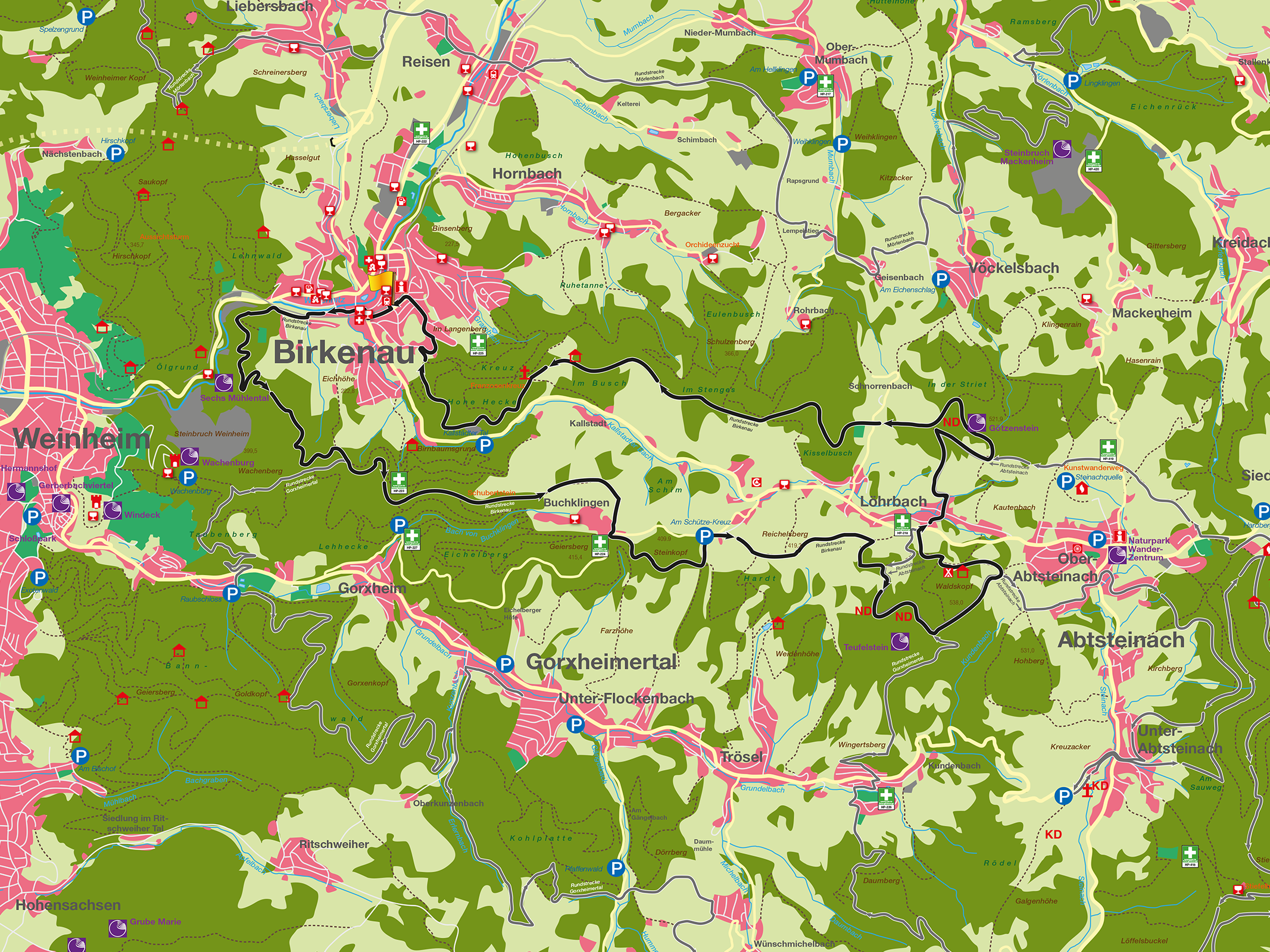
The MTB circular tour starts at Birkenau railroad station and runs along the northern and southern ridges over the Kallstädter Tal valley to Löhrbach and Götzenstein. A steady uphill and downhill route through forests and meadows repeatedly reveals impressive views of the Odenwald, the Weschnitz valley and the Rhine plain. The route first leads through the old Birkenau town center, past the old town hall and along the Weschnitz towards Spenglerswald. The route leads to the Schubertstein on easy forest paths. On the outskirts of Buchklingen, you leave the forest and after a short, steep climb, wonderful views open up in all directions. Above Buchklingen, the K 15 is crossed and the route leads along a narrow single trail over the Steinkopf to the Schützenkreuz. Continue for 1.5 km on the green plan path (asphalt). The ascent to the Waldskopf begins with a hairpin bend, over partly narrow forest paths, past the Teufelstein natural monument (block of biotite granite) to the summit (altitude 538 m). The strenuous ascent is followed by a varied and relaxing descent to Löhrbach (altitude 410m). After crossing the L3408, the ascent to the Götzenstein begins, approx. 600 m on asphalt then on an agricultural road. The further ascent to the Götzenstein is a single trail that is both sporty and technically demanding. The Götzenstein, a hilltop (altitude 521 m) with mighty granite boulders that indicate a Celtic or Germanic cult site (natural monument), is a good place to take a break for a drink. The descent from Götzenstein again requires the biker’s full concentration. The route then crosses the K 6 with a view of Schnorrenbach and the eastern Odenwald. The route continues on narrow forest paths towards Kisselbusch, from there it descends steeply, then along the ridge above the Kallstädter Tal with beautiful views over the Reisacker to the Franzosenkreuz. There, the route leaves the hiking trail and leads back to Birkenau on a narrow trail above the Kallstadt quarry through beautiful oak and beech forests.
Um dir ein optimales Erlebnis zu bieten, verwenden wir Technologien wie Cookies, um Geräteinformationen zu speichern und/oder darauf zuzugreifen. Wenn du diesen Technologien zustimmst, können wir Daten wie das Surfverhalten oder eindeutige IDs auf dieser Website verarbeiten. Wenn du deine Zustimmung nicht erteilst oder zurückziehst, können bestimmte Merkmale und Funktionen beeinträchtigt werden.
Funktional
Immer aktiv
Die technische Speicherung oder der Zugang ist unbedingt erforderlich für den rechtmäßigen Zweck, die Nutzung eines bestimmten Dienstes zu ermöglichen, der vom Teilnehmer oder Nutzer ausdrücklich gewünscht wird, oder für den alleinigen Zweck, die Übertragung einer Nachricht über ein elektronisches Kommunikationsnetz durchzuführen.
Vorlieben
Die technische Speicherung oder der Zugriff ist für den rechtmäßigen Zweck der Speicherung von Präferenzen erforderlich, die nicht vom Abonnenten oder Benutzer angefordert wurden.
Statistiken
Die technische Speicherung oder der Zugriff, der ausschließlich zu statistischen Zwecken erfolgt.Die technische Speicherung oder der Zugriff, der ausschließlich zu anonymen statistischen Zwecken verwendet wird. Ohne eine Vorladung, die freiwillige Zustimmung deines Internetdienstanbieters oder zusätzliche Aufzeichnungen von Dritten können die zu diesem Zweck gespeicherten oder abgerufenen Informationen allein in der Regel nicht dazu verwendet werden, dich zu identifizieren.
Marketing
Die technische Speicherung oder der Zugriff ist erforderlich, um Nutzerprofile zu erstellen, um Werbung zu versenden oder um den Nutzer auf einer Website oder über mehrere Websites hinweg zu ähnlichen Marketingzwecken zu verfolgen.